
A prototype of a US underwater drone, known as “Manta Ray“, has been discovered by users on Google Maps.
+ Netflix revives “Pimp My Ride” with the new series “Resurrected Rides” about extravagant cars
The Manta Ray can be observed at the Port Hueneme naval base in California, specifically located at coordinates 34°09’13.0″N 119°12’31.0″W, via Google Maps. Check it out: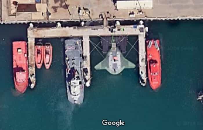
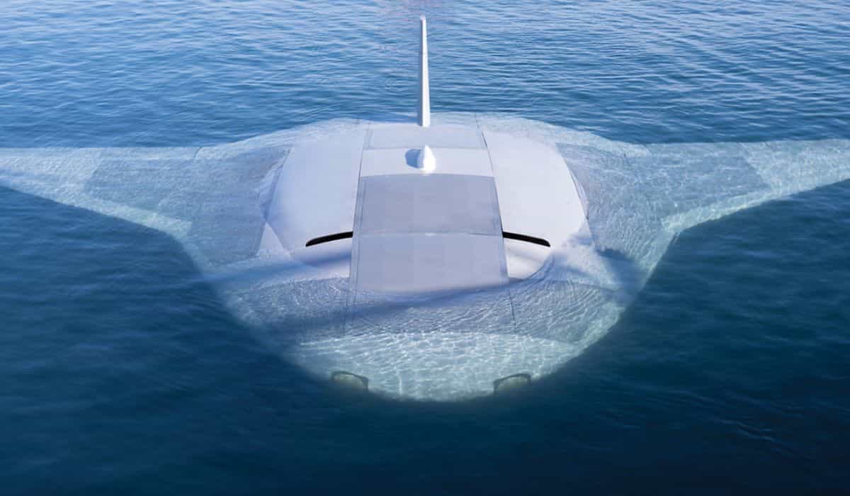
Produced by Northrop Grumman, the Manta Ray is an advanced underwater drone capable of hibernating on the seabed for long periods without refueling, using an efficient sliding system powered by buoyancy.
The drone’s modular design allows for disassembly and transport in standard containers, facilitating logistics without the need for specific port facilities.
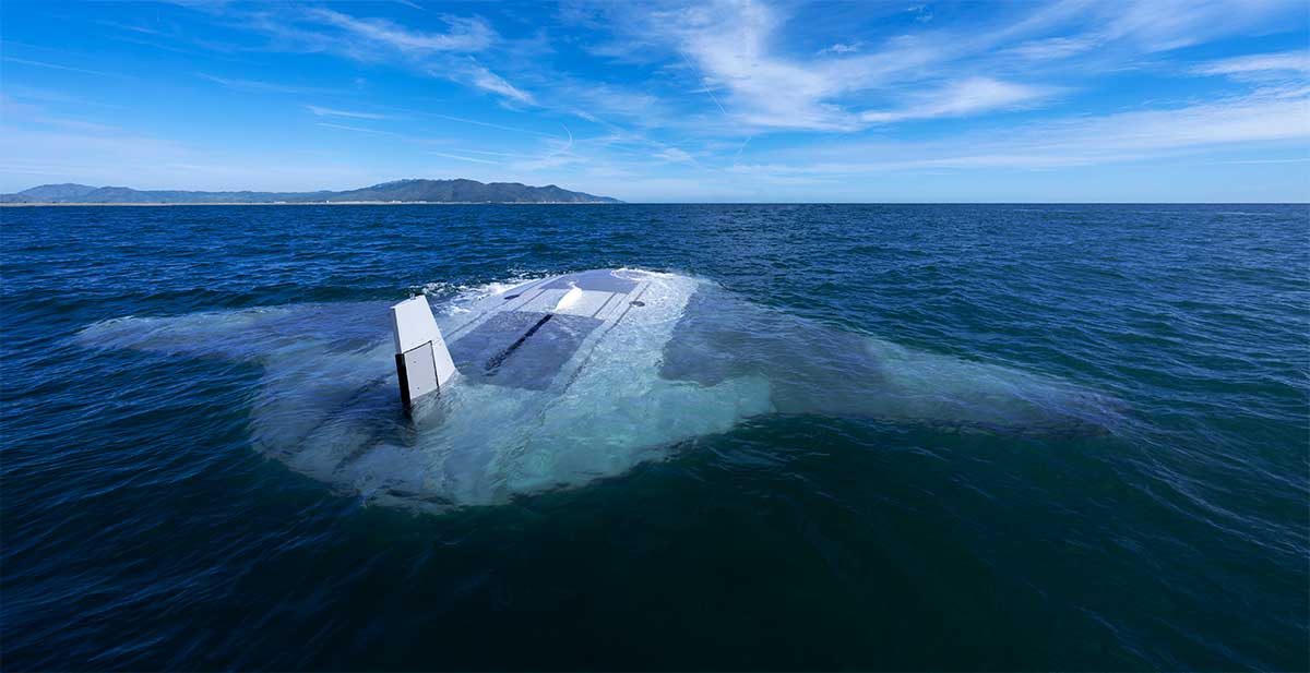
Developed as part of a US Navy project to create long-range underwater weapons, the Manta Ray was tested for over three months off the southern California coast. Defense analysts believe this development aims to counter submarine operations by Russia and China.
Source: New York Post
Photos: Darpa and Instagram | This content was created with the assistance of AI and reviewed by the editorial team.
Ver essa foto no Instagram
