
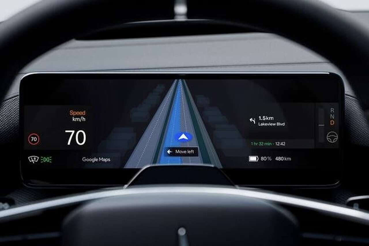
Missing an exit on a route can be a major headache, especially if the next turnaround is many kilometers ahead. With that in mind, Polestar is implementing an integrated real-time lane guidance system from Google Maps.
The new feature will first arrive for the Polestar 4, according to Car Magazine. As an extension of the existing infotainment system powered by Google, this functionality will show drivers exactly which lane they should be in, in real time, through the instrument cluster.
According to Polestar, the system uses a front-facing camera to detect which lane the car is currently in. Then, the vehicle will use “Google’s advanced artificial intelligence to analyze road elements such as lane markings and traffic signs.”
When navigating through Google Maps, the 10.2-inch display of the Polestar 4 will show all available lanes for the chosen route, as well as which lane the car is currently in. The goal, according to the brand, is to reduce the stress of last-minute lane changes.
“Over the past five years, Polestar’s collaboration with Google has brought many new features to Polestar vehicle owners,” said Sid Odedra, Head of UI/UX at Polestar.
“Live Lane Guidance continues Polestar’s driver-centric user experience strategy, reducing stress behind the wheel and improving safety, making missed exits and last-minute lane changes much less concerning.”
The innovation will first reach Polestar 4 owners in the United States and Sweden, although the update is only scheduled to arrive in “a few months,” according to the brand.
Photo: Polestar. This content was created with the help of AI and reviewed by the editorial team.
