
Hurricane Erin reached the maximum intensity on the Saffir-Simpson scale last Saturday (16), becoming a category 5 storm with winds of up to 260 km/h (161 mph).
+ North Macedonia Receives 29 New Oshkosh JLTV Armored Vehicles
Before moving toward the Bahamas archipelago, the phenomenon weakened and was downgraded to category 3, although it still poses a significant threat to the region.
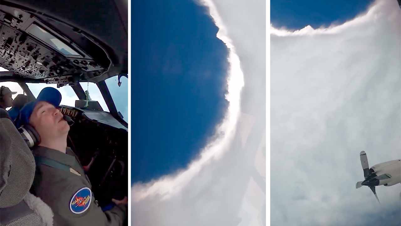
Striking footage released by NOAA (the U.S. National Oceanic and Atmospheric Administration) shows the moment specialized agency pilots flew directly into the eye of the hurricane on a reconnaissance mission known as hurricane hunters.
+ Click here to watch the video
These flights provide crucial data on atmospheric pressure, wind intensity, and storm movement — indispensable information for predicting its behavior.
Even after being downgraded to category 3, Erin maintains dangerous sustained winds capable of causing structural damage, power outages, and life-threatening conditions in exposed areas.
In addition to the Caribbean, parts of the U.S. East Coast may feel indirect effects such as large waves and strong ocean currents.
Source and images: NOAA Aircraft Ops Center. This content was created with the help of AI and reviewed by the editorial team.
Ver essa foto no Instagram
